|
Home >Locally-based projects >
Making a Community Resources Map
in Kbal Romeas and Sraekor Villages in Stung Treng Province, Cambodia
Background


In July 2014, Mekong Watch, in collaboration with 3S Rivers Protection Network (3SPN), started to help two villages, Kbal Romeas and Sraekor, in Stung Treng Province, northeastern Cambodia, draw a map to show natural resources that they rely on. These villages are being affected by the Lower Sesan 2 (LS2) Hydropower Dam, which is being constructed on the Sesan River, 1.5km downstream from its confluence with the Srepok River and 25km from where the two rivers meet the Mekong River mainstream.
For more information on LS2;
http://www.mekongwatch.org/english/country/cambodia/LS2/index.html
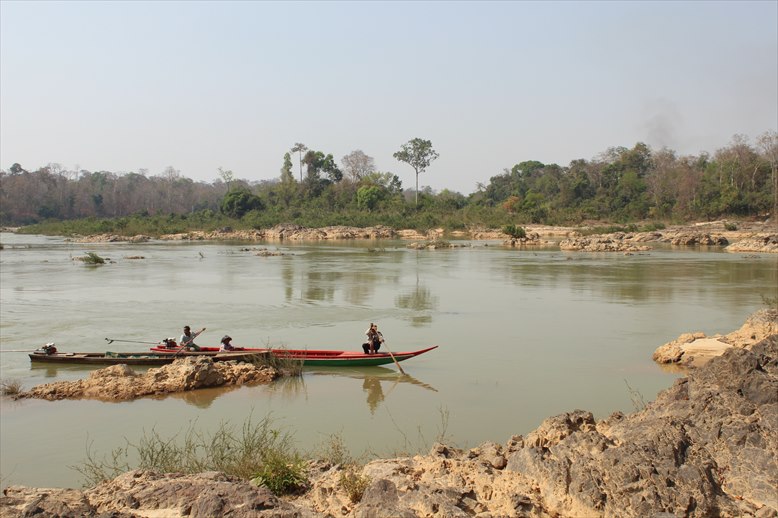
5km from the LS2 Dam construction site on the Sesan River
Many villagers, especially those living in the two villages, have explicitly voiced concerns and objections to the project. We hoped that a community resources map could help the two villages rediscover rich natural resources they had been enjoying, as well as their close links with the villages history, tradition, culture, and ways of life. Villagers could also use a map to explain the value of natural resources in the community to outsiders, including proponents of the LS2 project, as well as to back up their concerns, claims, and feelings, such as We dont want to be relocated and Our culture and tradition cannot be moved to other places. A visual representation, such as a map, would also be an effective tool for community empowerment, as many villagers belong to ethnic minorities and their reading abilities in Khmer may not be strong.
What are the purposes of map-making?
1) To raise villagers awareness over:
- What natural resources they have;
- How important the natural resources are to their survival; and
- How rich and valuable the natural resources are.
2) To strengthen villagers abilities to articulate:
- How they have used and managed the natural resources;
- What experiences, histories, stories, events, etc. they have around the natural resources; and
- How much they are concerned about and affected by losing the natural resources, especially due to the LS2 project.
The two villages
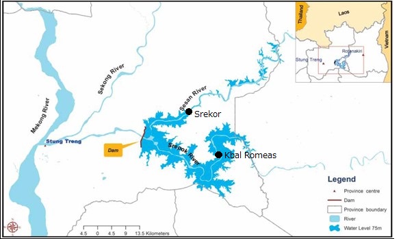
Map of the LS2 reservoir and major villages in the river basin (Vicheka 2012)
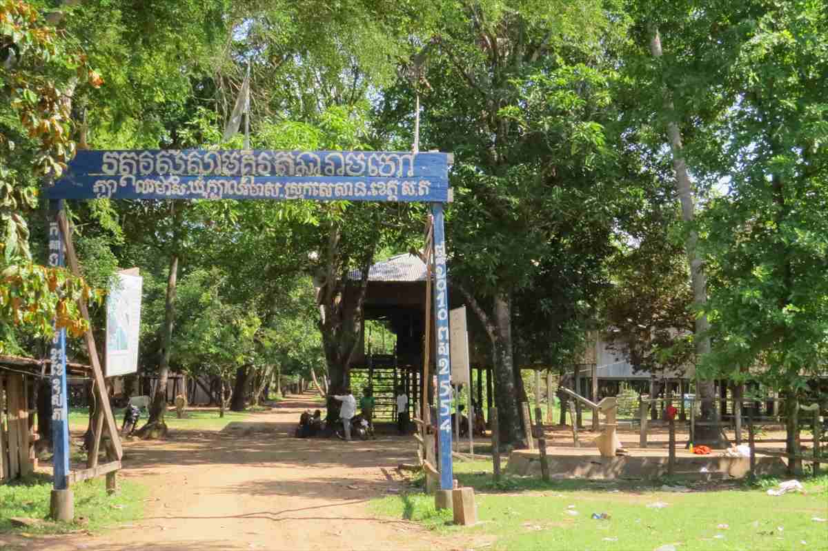
1) Kbal Romeas Village
It is located along the Srepok River and will be inundated by the LS2s reservoir. The village was built in 1962. Most villagers belong to the ethnic Phnong minority. Their tradition and life have strong connections to sprit beliefs and natural resources.
Kbal Romeas Village (photo by 3SPN)
2) Srekor Village
It is located along the Sesan River and will also be flooded when the LS2s reservoir is filled up. Most villagers belong to the ethnic Lao minority. Srekor villagers moved to the current location in 1955.
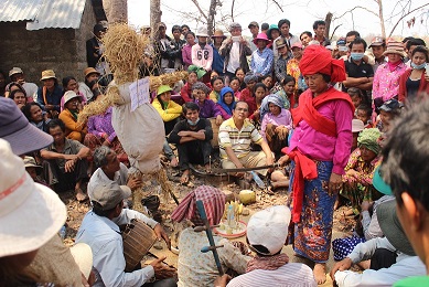
Praying for the Kro Hom Kor Sprit at the Srekor Village
What are the processes of making a map?
1. Facilitator training
At the beginning of a map-making exercise, facilitators were selected from among villagers. Facilitators were expected to lead the activity by encouraging other villagers involvement and by trying to raise their awareness over natural resources in the village. Facilitators were told not to give answers to villagers but to encourage them into thinking and coming into realization by themselves.
At Kbal Romeas, one youth leader, three youth members and two elders (all males) were chosen to be facilitators. They were chosen because some of them had stronger abilities to read and write, and had more knowledge over where natural resources were. On the first day of map-making, facilitators learned to draw a resources map themselves as part of their training.
Facilitator training at Kbal Romeas (the top photo by 3SPN)
2. Drawing a map
1. Making a list of natural resources in the village
One facilitator asked participating villagers what kinds of natural resources they could think of, and other facilitators wrote down the villagers answers on Post-it stickers. To make it easer for the villagers to respond and to make clearer links between natural resources and their daily life, the facilitator asked the villagers easy-to-answer questions such as:
- What did you eat for breakfast this morning?
- (Pointing at rice in a bowl) Where did we get this rice?
- (Pointing at fish at a table) Where did we get the fish?
- When you cooked this morning, what materials did you use?
- Where did you get fire wood?
- Where did you get a pan? Where did get the money to buy it?
At Srekor Village, to make villagers feel more comfortable, as well as and to make the activity more enjoyable, map-making was formed into a game in the following way:
Every time a facilitator asked a question, the facilitator tossed a ball to one villager. The villager who got a ball had to answer the question. Another facilitator wrote down the villagers answer on a sticker.
Map-making at Srekor
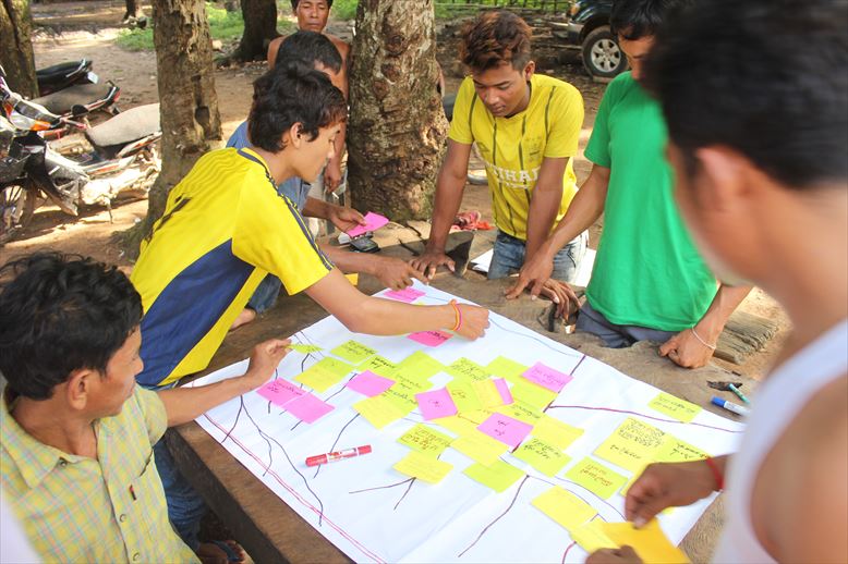
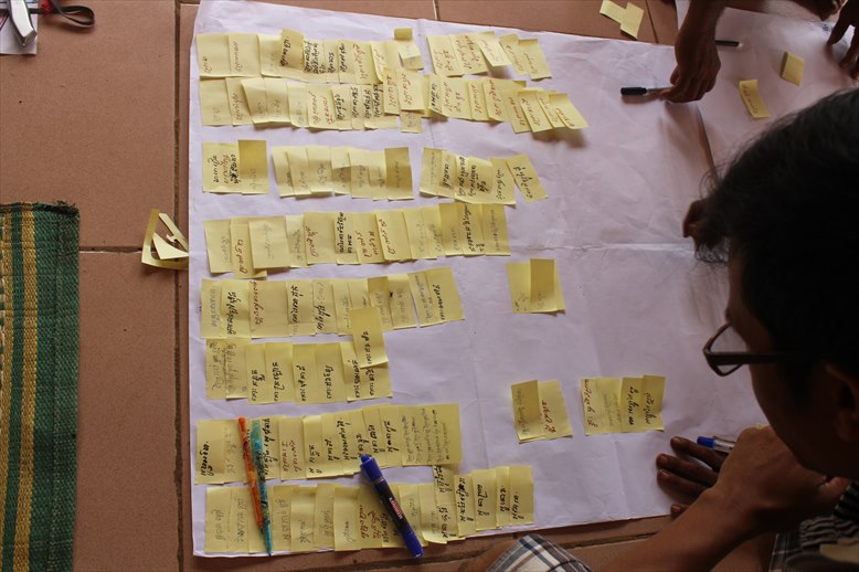
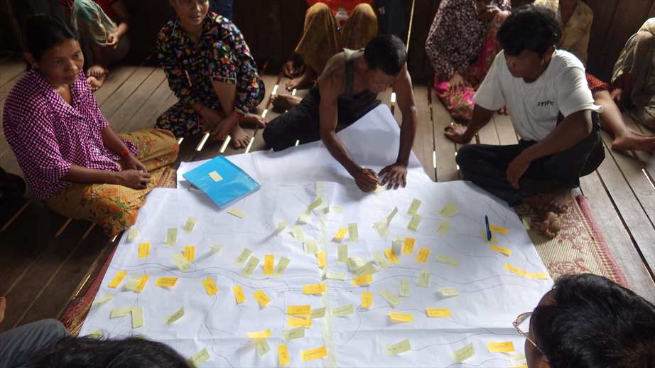
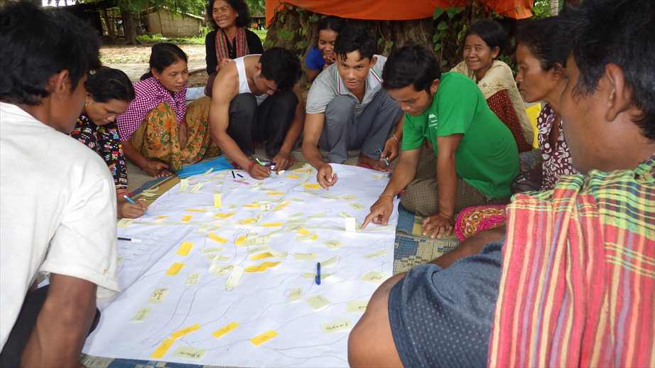
2. Pasting natural resources on to a blank map
After all the natural resources that the villagers were able to think of were written down on Post-it stickers and pasted on butcher paper, map-drawing started.
First, the facilitators wrote in major landmarks in the village, such as a river, on a big blank sheet of paper. Then, one facilitator took one Post-it on the butcher paper, held it high so that all the participating villagers could see it, and asked them, for instance, Where do you find Preh Poeak Pond? The villagers responded, while pointing at the direction of the pond, Over there. Behind our village. The facilitator then put the sticker on the proper position of the blank map.
The facilitator repeated questions-and-answers until all the Post-it stickers were transferred on to the map. Elders who had much knowledge of the village, especially locations of natural resources, helped this process a lot, whereas women and younger people, who had not seen or been to areas far from the village, were able to learn from the elders what natural recourses were available and where.
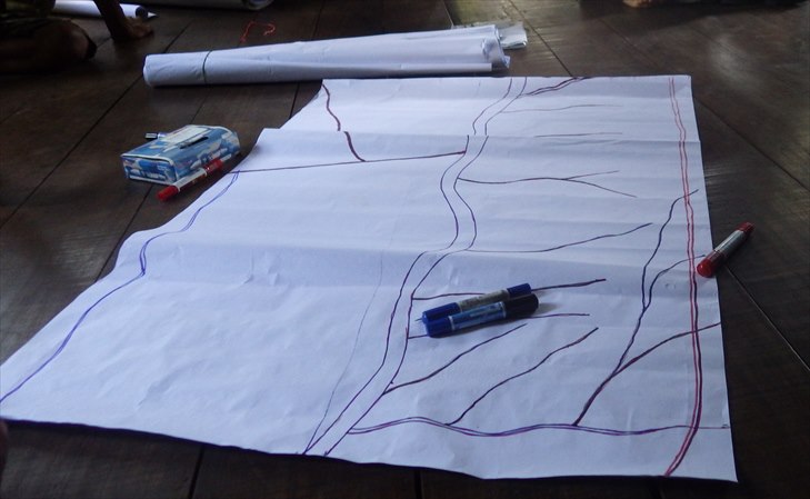
A blank map with a river as a landmark (at Kbal Romeas)
(photo by 3SPN)
Transferring all the Post-it stickers on to a blank map (at Kbal Romeas)
(the bottom photo by Facilitator from Youth Group)
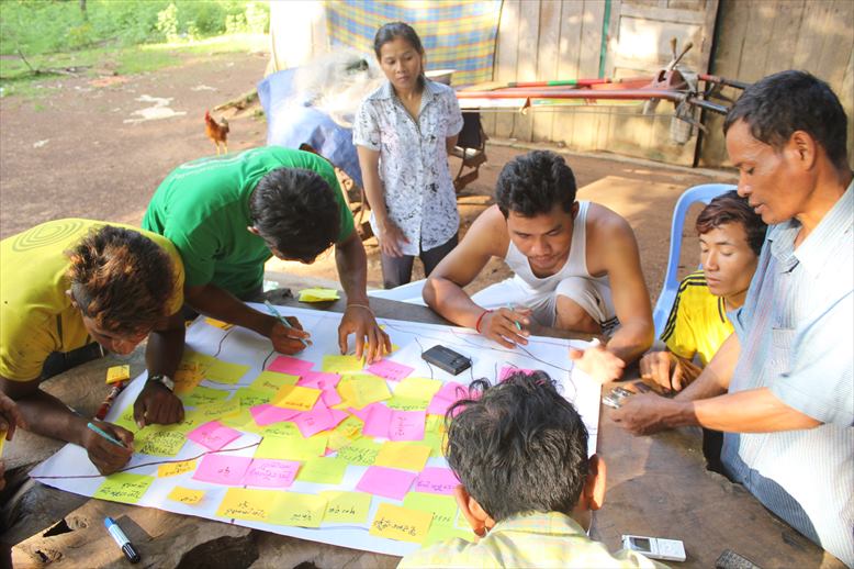
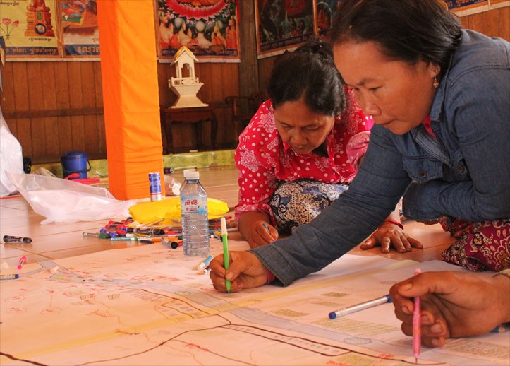
3. Drawing pictures on the map
After having moved all Post-it stickers on to the map, the villagers were asked to draw a picture of each natural resource. To make it easier for pre-literate villagers to join, the facilitators distributed pens and pencils with different colours to them. The villagers were encouraged into discussing and agreeing on what kind of picture with which colours would be most appropriate for everyone in the village to be able to recognize what it was. They then drew a picture next to each Post-it sticker on the map.
Every time someone completed a picture, the Post-it next to the picture was removed, until the villagers finished drawing pictures of all the natural resources on the map. A community resources map was completed.
Villagers drawing pictures on the map (at Kbal Romeas)
(photo by Facilitator from Youth Group)
Villagers drawing pictures on a map (at Srekor)
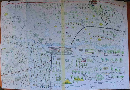
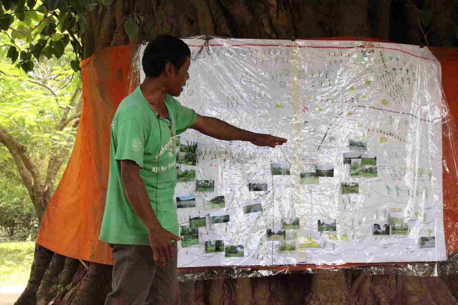
A map made by Kbal Romeas villagers
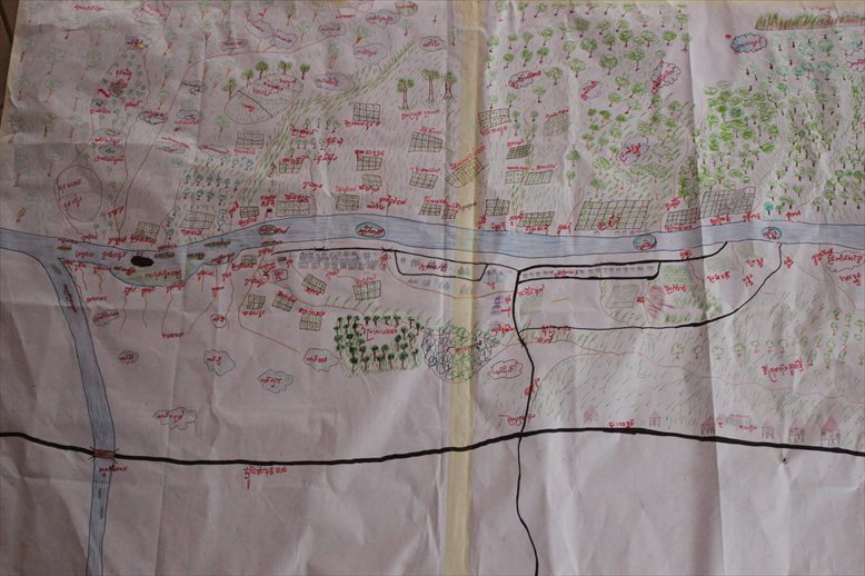
A map made by Srekor villagers
3. Taking photos of natural resources
To make it even easier for all the villagers to recognise the natural resources on the map, the facilitators went out to visitthe location of major natural resources in the village and took photos to show to the villagers.
Before going out, some villagers had to learn how to use a camera. Then the villagers were divided into smaller groups. Each group had at least one villager who had good knowledge of the location of the natural resources and another, usually one from a youth group, who knew how to operate a camera. One of the intentions behind this task was to encourage youth members into visiting the natural resources that they had never seen or been to.
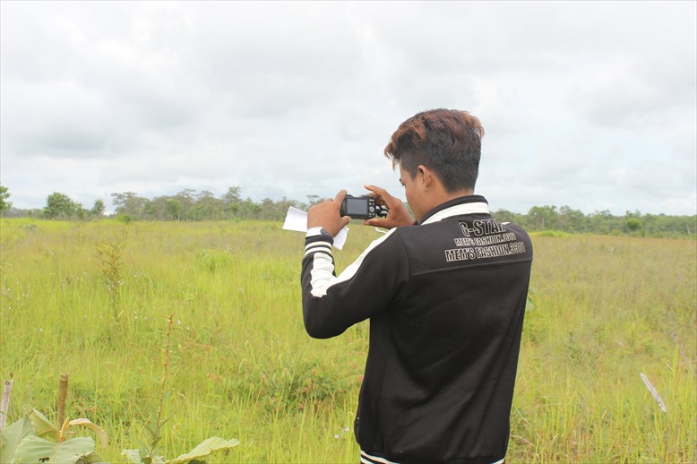
A youth group member taking a picture of the rice field (at Kbal Romeas)
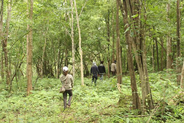
One group went to a forest to take photos and met with a villager who lived near-by. The villager offered to guide the group in the forest.
Because Kbal Romeas Village was huge, it took the villagers one entire day to obtain photos of only less than a half of the locations they had identified on the map. All the photos were printed on small-sized stickers so that the villagers could easily add on to the resources map.
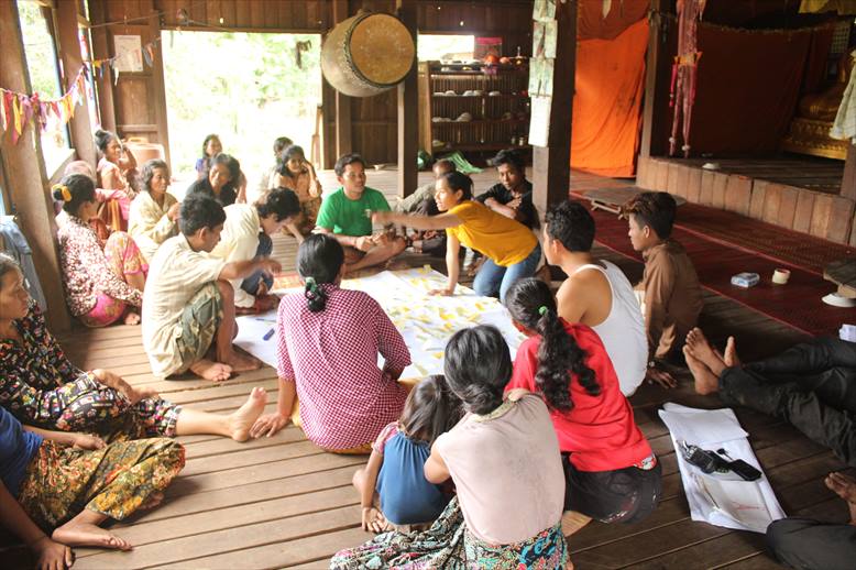
How did the villagers use the map?
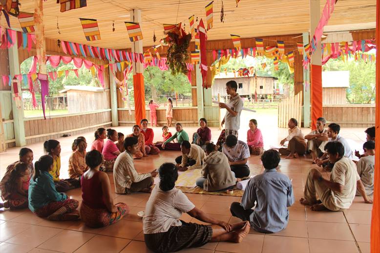
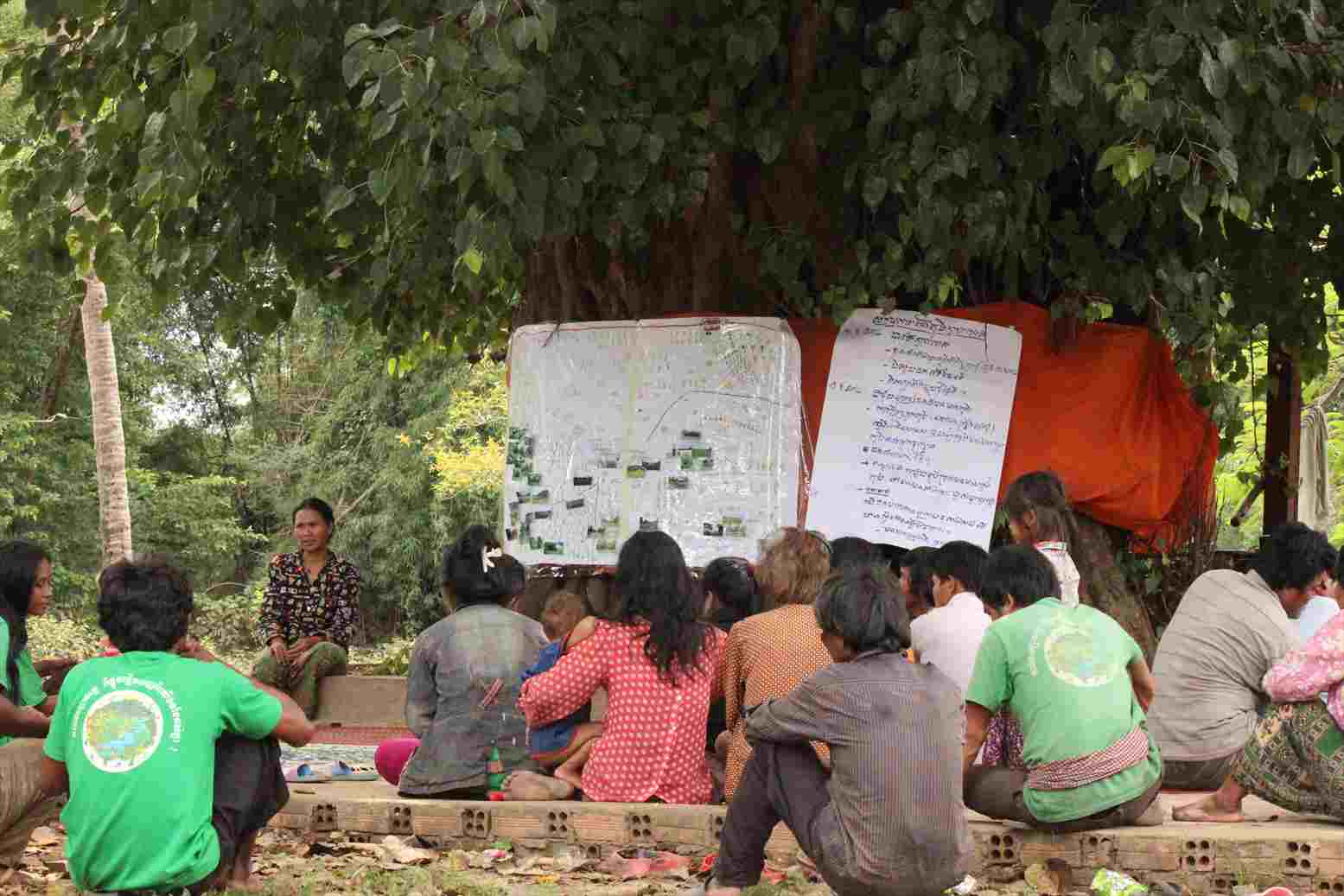
In August, Mekong Watch and 3SPN helped organize another workshop at Kbal Romeas Village to show the completed map to as many villagers as possible.
At the beginning of the meeting, a facilitator explained that the map could show natural resources and their locations in the village and said, I know Phnom Reung (Reung Mountain) and there are many resources there, but I dont know much about what kind of resources they are and how we have been using them. When someone comes from the outside and asks us about our village, each of us should be able to answer and explain about these natural resources.
On this day, three men and two women volunteered to take turns to come to stand up in front of the map, and shared their knowledge about each place on the map, for instance, the name of the place, why they were named as they were, how the village had been using the natural resources around each place, and what changes were happening these days.
presentation
What did the villagers think of the map?
Rithy, Facilitator from the Youth Group at Kbal Romeas
On the day I took photos of various places in our village, I felt happy to learn about the places and what kind of natural resources we had in our village. I became willing to ask other villagers to protect the areas that I took pictures of and recorded on the community map.
I think making a map is very important to us. Community members can understand importance of natural resources and where they exist. They recognize importance of resources to our life more easily.
I suggest to other villages that havent made a community map yet that they should join us and make a map for their village/community, too.

Yem Channy, a Youth Group member at Kbal Romeas
The map is very useful because we can learn more about where we live now, places where we haven't been to, as well as which areas belong to us.
Dam Bang, a Kbal Romeas villager
Our community worked together to make this map. I think making a community map is so useful to us. Even after moving to another place, we can use this map to show others how much land we have had. The company told us that this land is going to be taken (for the Lower Sesan 2 Dam), and in exchange we will move to live in a new place. I would rather live on hills here than living in a new village, because if we move to a new village, we will lose our traditions and our ancestors' tomb.
Note: All the photos on this page were taken by Mekong Watch in 2014 unless otherwise specified.
Last updated: October 16, 2014
| 